We utilize laser scanners to collect detailed site data from different viewpoints, guaranteeing thorough coverage for every area. This meticulous scanning technique leaves no parts of the sites missed and helps provide you accurate and complete information.
Our qualified personnel uses AutoCAD to create precise 2D drawings from your point cloud data. Using sophisticated tools and software, we transform raw laser scan data into clean and exact plans by meticulously addressing each detail.

Our experts create precise models using complex methodologies to ensure accuracy with your specifications on every model based on analyzed AutoCAD and Revit files.
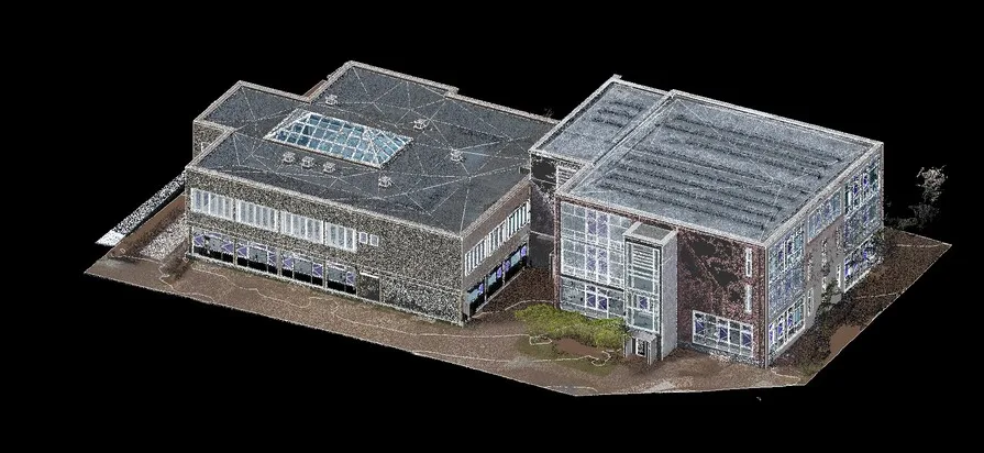
There is increasing interest in point cloud modeling due to its efficiency and precision. Onsite measurements can be tedious and filled with inaccuracies; however, point cloud scanning greatly accelerates the process while offering high accuracy. This technique decreases both the time required to capture structural details and errors that commonly occur during measurement.
Our team utilizes powerful computing resources to expedite processing scanned information, ensuring optimal efficiency alongside reliability. With modern surveying technology like point cloud modeling, faster timelines coupled with dependable data make this approach highly preferred.